The Eagle Has Landed
Greg captures an incredible moment in nature that few get to witness:
And he brought a fish.
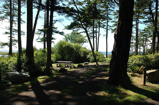
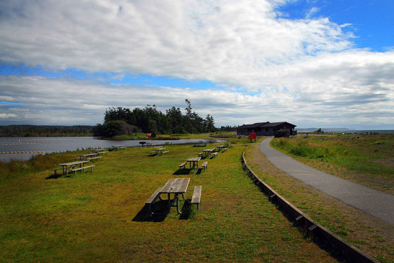
On my way to La Conner, WA, I stopped at Camano Island State Park.
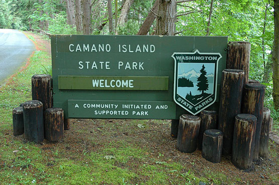

Earliest inhabitants of Camano Island were the Kikalos and Snohomish Indians, who used the island for a summer dwelling while gathering seafood and berries. They named it “Kal-lut-chin,” meaning “land jutting into a bay.” The island was renamed for Jacinto Caamaño, a Spanish explorer.
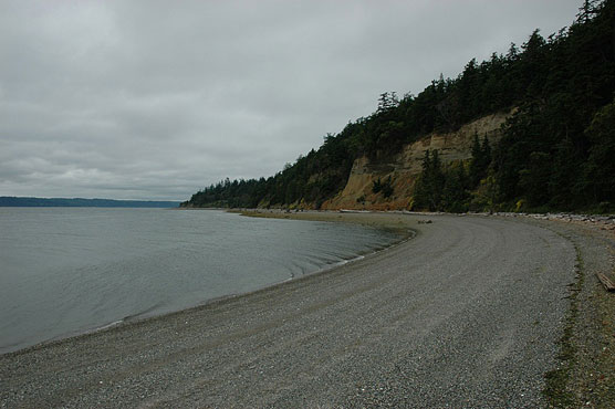
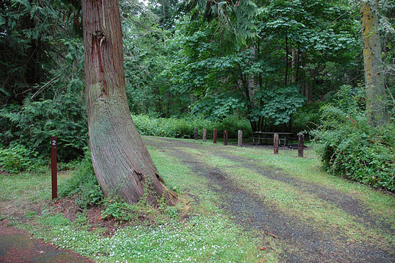
The park provides sweeping views of Puget Sound, the Olympic Mountains and Mount Rainier. Comb the beach, watch the boat traffic, or hike the forest loop trails. There are over 80 good size sites here.
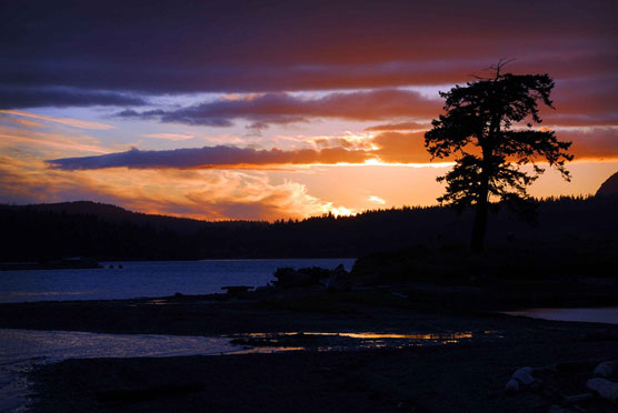
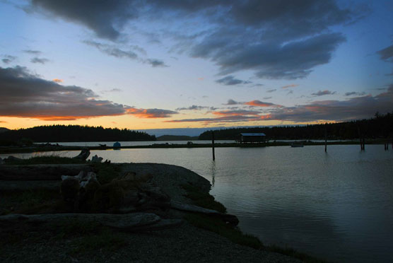
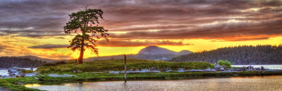
As you can see, the weather is still wet. Sunday night brought a clearing of the clouds and with it my first sunset of the trip.

Monday dawned clear and quite a bit warmer. So I hit the road to check out 3 more State Parks. There are 7 Forts scattered around the Puget Sound and two of them are on Whidbey Island.
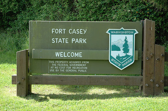
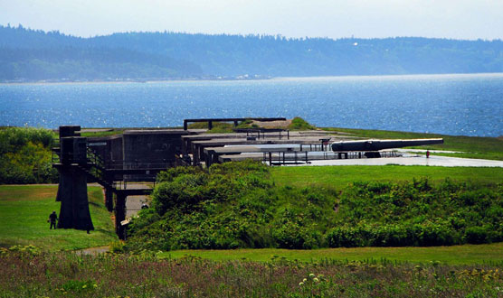
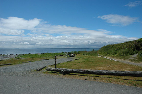
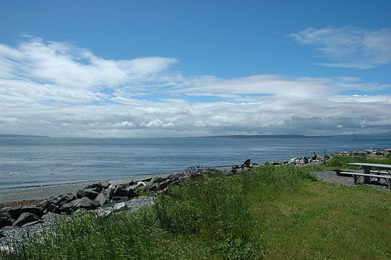
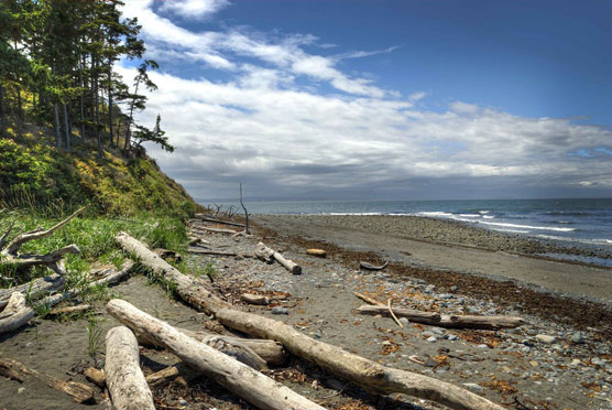
Fort Casey State Park is a 467-acre marine camping park with sweeping views of Admiralty Inlet and the Strait of Juan de Fuca. A coast artillery post features two 10-inch and two 3-inch historic guns on display. The park features 10,810 feet of saltwater shoreline on Puget Sound (Admiralty Inlet), and includes Keystone Spit, a two-mile-plus stretch of land separating Admiralty Inlet and Crocket Lake.

Some of the campsites are right next to the water.
There is a ferry that runs from here to Port Townsend. The landing is about a 7 iron from the campground. I took this photo from the campground.
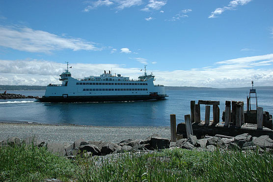
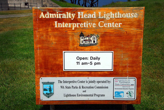
Fort Casey also has a nice beach and a funky looking lighthouse.
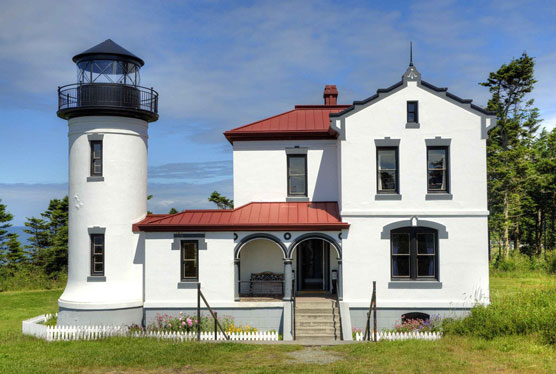

I would like to live in something like that.
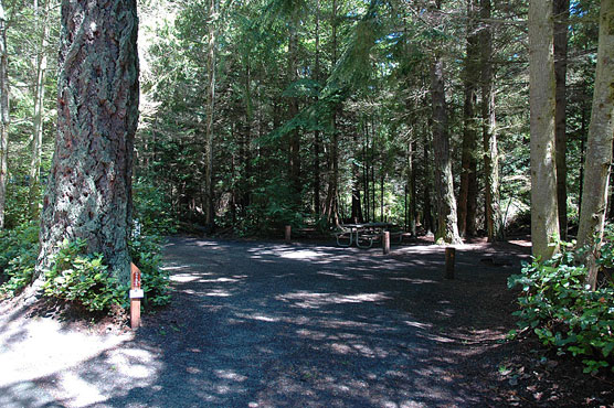
Next stop was Fort Ebey.
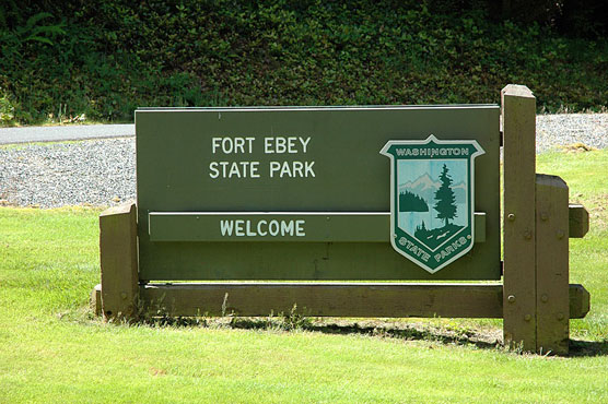
Fort Ebey State Park, a 645-acre camping park on Whidbey Island, was originally built as a coastal defense fort in World War II. Concrete platforms mark the gun locations. The park has three miles of saltwater shoreline on the Strait of Juan de Fuca, a freshwater lake for fishing, and miles of hiking and biking trails.
Whereas the campsites at Casey were out in the open near the beach, the ones at Ebey are set back in the forest.
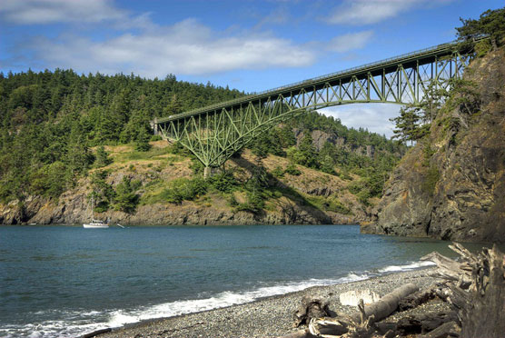
Finally I visited the biggie, Deception Pass State Park.
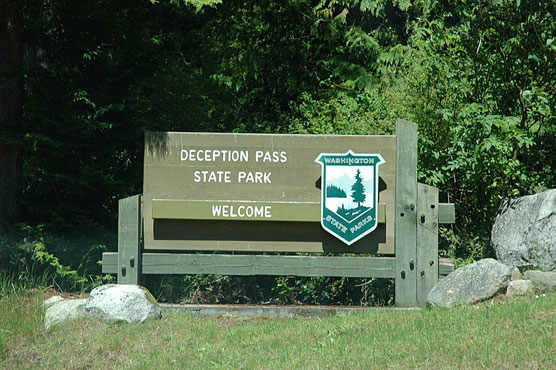
Deception Pass State Park is a 4,134-acre marine and camping park with 77,000 feet of saltwater shoreline, and 33,900 feet of freshwater shoreline on three lakes. Rugged cliffs drop to meet the turbulent waters of Deception Pass. The park is outstanding for breath-taking views, old-growth forests and abundant wildlife.
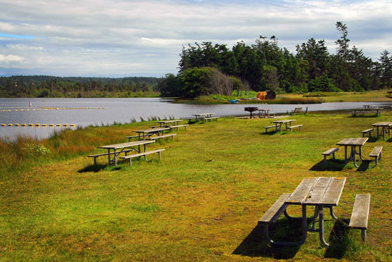
There are 230 campsites and 5 more for hikers/bikers in the main campground at Cranberry Lake.
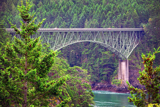
The campground is located on WA 20 about 10 miles away from where I was staying in La Conner. To get there you have to pass over Deception Pass Bridge.
The name “Deception Pass” derived from Captain George Vancouver’s realization that what he had mistaken for a peninsula was actually an island. He named that island “Whidbey” in honor of his assistant, Joseph Whidbey, who was at his side when Vancouver realized the mistake. The captain named the inlet at which he was anchored “Deception Pass” to commemorate the error.
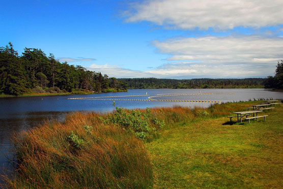
One of the highlights of this park is the area around Cranberry Lake, which is separated from the ocean by only a few hundred feet.
Here is the the lake and swimming area.
Turning right you can see the canoe area.
A little more right and you can see the lake and the ocean at the same time.
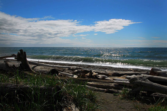

This beach is called West Beach. A short hike leads to North Beach where you get a different view of the bridge.
I titled this post “The Eagle Has Landed” for a reason, so bear with me. Below is my campsite at La Conner. To the left of the front of my car at about the same height as my roof, you can barely see a post. That post is about 200 yards from my tent out in the bay. Saturday afternoon I was reading in the screen house while the rain poured down. I heard a loud splash and saw a big bird flying skyward from the water.
I always keep my camera handy, but I do not own the right type of camera lens for this situation. I needed about a 500 – 600 mm lens to get sharper images without having to crop the photos so much. So I apologize for the quality of these next pictures.
OK, disclaimer is out of the way. This is what I saw.
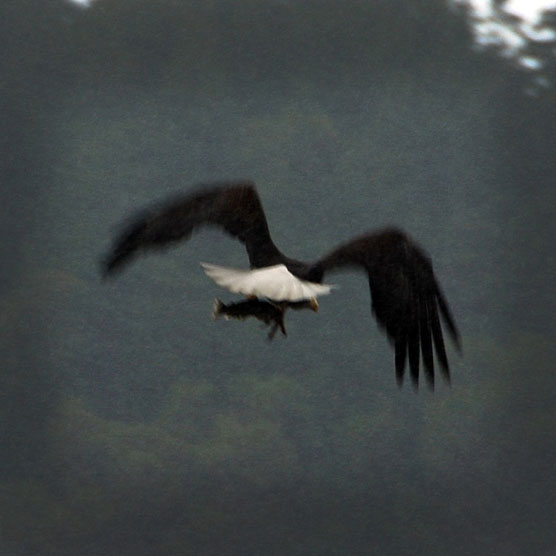

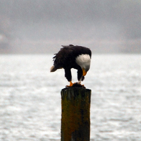
You can see the small salmon in his claws. Next, he lands on the post.
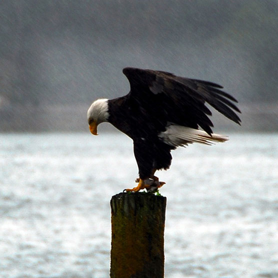
Notice the driving rain. In the next picture you can clearly see the fish.
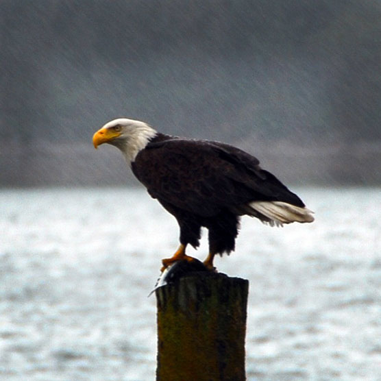
Look at that beak and those claws. Fish never had a chance!
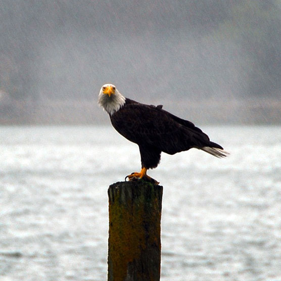
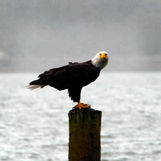
Talk about eagle eye vision, I was in the trees and I swear he looked right at me.
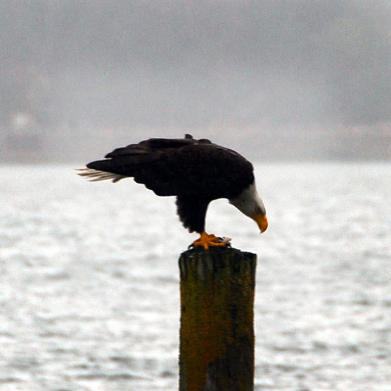
He turned around and in the second photo you can see him pulling some flesh from the fish.
I must have said something because he turned and gave me another stare and flew away.
On Wednesday I headed north about 60 miles to Birch Bay where I will be camping for the next 4 nights. The weather has been nice for the past few days, but the rains are scheduled to start up again on Friday.
So let’s have one more look at my first sunset of this trip. I shot this version in RAW format as opposed to JPEG and ran it through an HDR program. All that means is that it makes the photo kinda surrealistic but I think it works for the subject.

Regards, Park Ranger
No Comments
Visit full-site to leave a comment